Knowing your property lines is key for homeowners and those looking to buy property. It helps avoid disputes and ensures land is used right. Babcock Ranch Homes knows how vital clear boundaries are in real estate and managing personal property.
Property markers show exactly where your land ends. Knowing these lines stops problems with neighbors and helps with home improvements. Sadly, about 70% of homeowners don’t know where their property lines are, making this info very important.
Whether you’re planning to renovate your home or dealing with neighbor issues, knowing your property lines can save you a lot. There are many ways to find these lines, from digital tools to professional surveys.
Key Takeaways
- Property lines are essential for understanding land ownership
- Multiple methods exist to identify property boundaries
- Professional surveys provide the most accurate property line information
- Digital tools can help preliminary property line research
- Understanding property lines prevents possible legal disputes
Understanding Property Lines and Their Importance

Property lines are invisible but very important. They show who owns what land. They help manage real estate and keep neighbors friendly. By finding property corners and surveying, you learn where your land ends.
Knowing your property lines helps you decide how to use your land. It stops you from accidentally taking someone else’s land. This also avoids legal problems.
Defining Property Lines
Property lines are set by exact measurements and legal papers. They can be found in several ways:
- Metal survey stakes
- Historical property records
- Professional land surveys
- County recorder’s office documentation
Legal Implications of Property Boundaries
Property lines are very important legally. They help avoid disputes and follow local rules. Surveying your land keeps you safe from legal issues and unauthorized use.
Role in Property Ownership
Property lines are key to owning land. They decide:
- What you can do with the land
- How far you can build
- If there are easements
- How much property tax you pay
Approximately 95% of U.S. properties have accessible boundary data through digital mapping tools.
For homeowners and investors, knowing property lines is more than a legal rule. It’s a smart way to manage your land well.
Official Property Documentation Methods
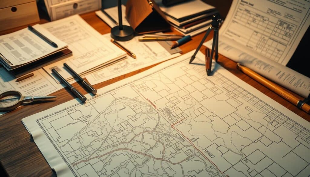
Land surveys are key for property owners who need to know their boundaries. The Rectangular Government Survey System, started in 1785, helps make legal property descriptions. This system is reliable and systematic.
There are several ways to document property lines accurately. Professionals use different methods to ensure the right information:
- Metes and bounds method (oldest land measurement technique)
- Rectangular Survey System
- Plat method (lot and block approach)
Important documents for legal descriptions include:
- Land surveys
- Property deeds
- Title commitments
- Real estate contracts
Today, technology has made surveys more precise. GPS and drone technologies help measure property more accurately. This reduces old challenges in documentation.
A detailed land survey must include the property’s legal description, street address, and more. It also covers adjacent properties, structural improvements, and current easements.
Many counties now offer online access to property documents. This lets owners search by address, owner name, or parcel number. This digital access helps both homeowners and real estate experts understand land surveys better.
Using Digital Technology to Locate Property Lines
Digital technology has changed how we find and check our property lines. Now, with advanced mapping tools and apps on our phones, it’s easier than ever.

Property deeds and descriptions work well with today’s digital tools. This lets homeowners know exactly where their land is with more accuracy.
Google Maps Capabilities
Google Maps is a good start for finding property lines. You can:
- Enter your exact property address
- View aerial images of your property
- Get a basic idea of where your boundaries are
Property Line Apps and Tools
There are apps that help find property boundaries better:
| App Name | Key Features | Accuracy Range |
|---|---|---|
| LandGlide | GPS-enabled boundary tracking | Within 10-15 feet |
| Property Survey | Real-time parcel information | Within 5-10 feet |
| Zillow Lot Boundaries | Interactive property mapping | Within 20 feet |
Digital Mapping Resources
Digital mapping tools are very useful for property owners. About 70% of county governments use GIS platforms. These platforms share public property line info.
Even with digital tools, they can’t replace a professional land survey. It’s best to use them first, then talk to a licensed surveyor.
Professional Land Survey Services

When you need to know your property’s exact boundaries, a land surveyor is key. Homeowners hire them to get precise measurements and legal papers.
Land surveyors do more than just measure. They use the latest tools and methods. They make detailed maps and find exact markers for your land.
- Measure property boundaries with high-precision instruments
- Create official documentation for legal purposes
- Identify possible boundary disputes early
- Provide detailed property line reports
The cost to hire a land surveyor is usually between $375 to $750. This depends on how complex your property is and where it’s located. Costs can vary based on:
| Property Characteristic | Impact on Survey Cost |
|---|---|
| Property Size | Bigger properties need more time and effort |
| Terrain Complexity | Hard-to-reach areas make surveys harder |
| Historical Research | Looking through old documents can cost more |
Mortgage lenders and title insurance companies need proof of property lines. Hiring a land surveyor gives you peace of mind and legal safety.
For expert advice on land surveys, call Babcock Ranch Homes at 518-569-7173. They can help you understand your property’s boundaries and avoid future problems.
How to Find Property Lines Using Public Records
Finding property lines can be tough, but public records help a lot. They give you the exact spot where your land starts and ends.
Here are some ways to find out where your property lines are:
- Visit the local county recorder’s office
- Request historical property documents
- Analyze detailed plat maps
- Look into digital property databases
County Recorder’s Office Resources
The county recorder’s office has important documents. They help you find iron pins and solve boundary issues. You can get original deeds, survey reports, and property history here.
“Public records are the foundation of understanding your property’s true boundaries” – Real Estate Legal Expert
Accessing Historical Property Documents
Old property documents give great insights into land history. Online sites like Acres now let you see these records online. This makes it easier to avoid going to the office.
Understanding Plat Maps
Plat maps show property lines clearly. They show how different properties connect and where the lines are.
- Reveal property dimensions
- Illustrate neighborhood layout
- Help identify possible boundary disputes
Experts say to check many sources to be sure about property lines. Online tools can help, but a professional surveyor is best for exact answers.
Physical Markers and Survey Pins

Knowing where property lines are is key to avoiding legal issues. Survey pins are used to mark these lines. They are usually made of steel or iron and are placed carefully to show where the land belongs to whom.
There are different types of markers for property lines, each with its own job:
- Iron spikes or rebar driven into ground corners
- Concrete monuments
- Stone markers
- Wooden stakes
- Permanent metal caps
Surveyors put these markers in place during the first survey of a land. Most survey pins are 2 to 3 feet long and may be capped with protective plastic. Even though they help a lot, they can sometimes get moved by construction or landscaping.
Finding these markers can be a bit of a challenge. Homeowners can use metal detectors to locate them or check county records. Many places now have online systems that show where property lines are.
Accuracy is key when identifying property lines – a misplaced marker could lead to legal problems.
Getting a property survey can cost between $300 and $1,000. It might seem pricey, but it can save you from big fights with your neighbors.
Reading and Interpreting Property Deeds
Understanding property deeds is key for real estate deals and knowing land boundaries. These legal documents give detailed info on who owns the land and what it includes. They are vital for property owners and buyers to know what they have.
Property deeds use special terms and methods to show land boundaries. The oldest way is the metes and bounds survey. It uses natural landmarks and exact measurements to map out property lines.
Understanding Legal Descriptions
Legal descriptions in property deeds have important parts:
- Point of Beginning (POB)
- Precise boundary measurements
- Reference to local geographical markers
- Township and section references
Metes and Bounds Surveys
Metes and bounds surveys give detailed info on property lines. They often mention:
- Natural landmarks like trees, rivers, or rock formations
- Precise angular measurements
- Distance calculations
- Directional indicators
Property Deed Terminology
Understanding property deed language is important. For example, “Township 4 North, Range 2 East (T4N, R2E)” shows a property’s exact spot in a federal survey grid.
Accurate property descriptions are essential for preventing ownership disputes and ensuring clear land boundaries.
Property owners must know legal descriptions match in all documents. The FBI reported about 9,500 real estate fraud complaints in 2023. This shows why it’s critical to understand and check property deeds.
Working with Local Zoning Departments
Local zoning departments are key when finding property lines. They keep detailed records that show where your land ends and others begin. Knowing how to use these resources can save you time and avoid legal issues.
Zoning departments have important documents for property line research:
- Zoning maps showing property divisions
- Parcel Look-Up Tools with Assessor’s Parcel Numbers (APN)
- Land use records and historical property documents
- Detailed property classification information
When looking up property lines, you’ll need to give specific details. The Parcel Look-Up Tool uses the APN to find key information like:
- Property zoning classification
- Total acreage
- Site address
- Potential land use restrictions
Zoning rules vary by area. There are different zones like residential, commercial, and industrial. Each zone affects your property’s boundaries and what you can do with it.
The 1926 U.S. Supreme Court case Village of Euclid v. Ambler Realty established the constitutional validity of zoning ordinances, highlighting their importance in property management.
For accurate boundary info and to know any restrictions, contact your local zoning department. They can help you understand your property’s specific needs.
Natural and Man-made Boundary Indicators
Locating property corners is all about noticing natural and artificial landmarks. These landmarks give key clues about where property lines are. It’s important for property owners and buyers to know what these signs are.
Seeing visual cues is key to finding property lines. Surveyors and owners use many physical markers. These help pinpoint property corners more accurately.
Identifying Physical Landmarks
Natural boundaries are important for marking property. They include:
- Large trees at property edges
- Streams or water bodies
- Rock formations
- Natural terrain changes
Understanding Easements
Easements are legal rights that let others use your property. Property corners often meet these shared-use areas. This makes them key to understanding land boundaries.
Utility Markers and Boundaries
Utility infrastructure gives clues for finding property corners. These markers include:
- Underground utility flags
- Electrical junction boxes
- Water meter locations
- Street light placements
“Accurately identifying property boundaries requires a combination of physical observation and official documentation.” – Professional Land Surveyor
| Boundary Indicator | Reliability | Additional Verification Needed |
|---|---|---|
| Natural Landmarks | Medium | Survey Confirmation |
| Utility Markers | High | County Records |
| Easement Lines | Low | Legal Documentation |
Professional surveys are the best way to find property corners for sure. About 90% of title insurance companies need a boundary survey. This shows how important it is to get a professional check.
DIY Property Line Measurement Techniques
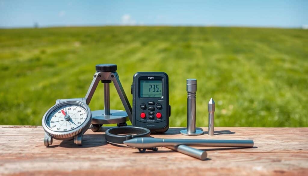
Surveying your land can be tough but very important for homeowners. While experts give the most precise results, you can try DIY methods first. They help you understand your property’s edges.
To start surveying your land, you need the right tools:
- Long measuring tape (100 feet recommended)
- Compass or GPS device
- Stakes and marking flags
- Metal detector
Accuracy is key when measuring property lines. About 70% of homeowners don’t know their exact boundaries. This can cause problems with neighbors.
“A careful DIY survey can provide initial insights, but always consult professional surveyors for legal precision.”
Here are the main steps to survey your land:
- Check your property deed for existing boundary descriptions
- Locate existing property stakes using a metal detector
- Measure distances between known markers
- Create a rough sketch of your property boundaries
- Compare your measurements with official records
Remember, DIY measurements aren’t legally binding. Professional surveys cost between $300 and $1,000. They can lower boundary dispute risks by up to 80%.
Recommendation: DIY methods can guide you at first. But, always check your findings with official documents. Also, think about getting a professional survey for important property decisions.
Property Line Disputes and Resolution Methods

Boundary disputes can quickly turn friendly neighbors into legal foes. When property lines are in question, owners face big risks. Almost half of these issues come from unclear boundaries.
Understanding boundary disputes is key. Here are some facts:
- About 30% of property line disputes lead to legal action
- Mediation solves around 60% of these problems
- A detailed land survey can clear up 85% of disputes
Proactive communication is vital. Talking regularly with neighbors can lower dispute chances by 40%.
“Prevention is always more cost-effective than litigation” – Real Estate Legal Expert
Boundary disputes can cost a lot. Legal fees can go over $10,000. A property survey, costing $100 to $600, can avoid expensive lawsuits.
Here are some ways to solve disputes:
- Talking it out with neighbors
- Professional mediation
- Boundary line agreements
- Getting legal advice
- Going to court (as a last resort)
Property owners should focus on clear records and communication. Knowing local laws and keeping property records up to date can help avoid conflicts.
Role of Title Companies in Property Line Verification
Title companies are key in real estate, helping buyers and lenders. They check who owns the property and if there are any legal issues.
When you buy a property, title companies do a deep dive. They make sure the ownership is clear and can be transferred.
- They do thorough title searches.
- They find any property line problems.
- They use special insurance to lower risks.
- They check property deeds and descriptions.
Title Searches and Property Boundaries
Title searches are vital in real estate. Over 90% of real estate transactions involve a title search to check ownership and find issues. These searches give important info about property lines, like:
- Existing liens
- Unpaid taxes
- Potential easements
- Boundary disputes
Insurance Implications
Title insurance is key for protection. About 80% of transactions involving existing homes recommend title insurance to guard against future problems.
| Type of Policy | Coverage Percentage | Average Cost Range |
|---|---|---|
| Lender’s Policy | 75% of mortgage transactions | $500 – $1,500 |
| Owner’s Policy | 60% of transactions | $1,000 – $2,500 |
The cost of title insurance is about 0.5% of the property’s price. It offers big protection against legal and financial risks tied to property deeds and descriptions.
Modern Technology in Property Line Detection

Finding property lines has become much easier thanks to new technology. Today, surveyors use advanced tools that are very accurate and fast. These tools help find where land boundaries are.
GPS technology has improved a lot, now giving results down to a centimeter. Licensed surveyors use these new tools to find property lines very precisely.
- Electronic theodolites measure angles with great precision
- Total stations capture angles and distances at the same time
- Drone surveying cuts down the time needed for field research
Now, there are apps that make it easy for homeowners to find property lines. The LandGlide app is a great example. It works in over 3,000 U.S. counties, giving you property info right on your phone.
| Technology | Accuracy | Coverage |
|---|---|---|
| GPS Surveying | Within 1 inch | Nationwide |
| Drone Mapping | High Precision | Large Area Surveys |
| Mobile Apps | Approximate | 95% of U.S. Counties |
Digital tools like Google Maps can give you a starting point. But, they’re not always right. For the best results, experts say to use different technologies together.
Legal Considerations and Property Rights

Property rights are a complex area of law that protects landowners’ basic rights. The U.S. Constitution gives key protections through the Fifth and Fourteenth Amendments. These ensure property owners get fair compensation and due process if their rights are challenged.
Property owners have a “bundle of sticks” that outlines their legal rights. These include:
- Right to occupy the property
- Right to use the property
- Right to transfer ownership
- Right to exclude others
- Right to modify or develop the property
Boundary disputes are a big issue in property law. About 30% of property deals face survey issues that can lead to legal fights. These problems often come from unclear property lines, encroachments, or misunderstandings between neighbors.
Legal ways to handle boundary disputes include:
- Professional land surveying
- Negotiation with neighboring parties
- Seeking legal mediation
- Filing a declaratory judgment lawsuit
Interestingly, about 25% of boundary disputes are solved through informal agreements or easements, avoiding expensive lawsuits. Good communication is key, with studies showing it can cut conflict rates by 40%.
Understanding your property rights is not just about legal protection, but about maintaining peaceful neighborhood relationships.
Modern tech like blockchain and artificial intelligence is changing how we manage property rights. They offer new ways for precise boundary documentation and solving disputes.
Maintaining Property Line Records
Keeping accurate records of property lines is key for homeowners. Property deeds and descriptions are vital. They protect your rights and avoid disputes. Keeping records right can save you a lot of time and money.
Effective record maintenance involves several key strategies:
- Digitize physical documents
- Create both digital and hard copy backups
- Organize documents chronologically
- Store in a secure, fireproof location
Property owners should collect and preserve important documents. This includes:
- Original property deeds
- Professional survey reports
- Plat maps
- City or county office boundary records
Digital storage has big benefits. With apps like LandGlide and Regrid, you can easily manage your property data. These tools cover 99% of U.S. properties.
| Document Type | Recommended Storage Method | Retention Period |
|---|---|---|
| Original Deed | Fireproof Safe + Digital Scan | Permanent |
| Survey Reports | Cloud Storage + Physical Copy | 10+ Years |
| Property Line Maps | Digital Archive | Permanent |
Regular updates are a must. After any changes like additions or subdivisions, update your records. Professional surveyors, who charge between $375 and $750, can help with these updates.
Proactive record-keeping is your best defense against property line conflicts.
Conclusion
Knowing how to find property lines is key for homeowners. You can use professional surveys or digital tools to locate corners. By researching public records and using technology, you can find your property’s boundaries accurately.
Land surveys are the best way to know your property lines. They cost between $376 and $745. This investment can avoid legal issues and even lower your insurance.
Babcock Ranch Homes suggests a detailed approach to finding property lines. Use digital tools, public records, and surveys to understand your land. For help, call our experts at 518-569-7173. We guide you through property line research with ease.
Investing time in property line research is smart. It protects your property and avoids problems with neighbors or local authorities. Knowing your property’s boundaries is vital for any homeowner.


